Hiking on Table Mountain is an enormously rewarding experience but it is a mountain that needs to be treated with caution. Although it is “only” 1000 metres (3500 ft) high, it is demanding. The top of the mountain is divided into 2 sections – the Front Table (the characteristic Table Mountain n) and the Back Table – 200 metres lower and extending all the way to Hout Bay. There is a useful map of the mountain that indicates the main routes – it is obtainable from CNA and Kirstenbosch.
¨ To walk up and down will take between 4 and 8 hours depending on your fitness. To walk
up and to come down by Cable Care will take 3 to 6 hours. Wear appropriate shoes.
¨ Although it is flat on top it is completely surrounded by cliffs – to get off the path is
dangerous.
¨ The weather at any time of the year can change within 30 mins from clear, sunny skies to
thick cloud and bitter cold so always take warm clothing.
¨ There are only 4 accessible routes where ropes or a Guide are not needed.
¨ Signage on the mountain is almost non-existent – keep to the main paths and take a map.
During summer there is no water, so take your own.
PLATTEKLIP GORGE: Up the front face of the mountain starting at the first stream that crosses the road past the lower Cable Station. The route ends at the top of the “notch” on the Front Face. This is the quickest route up (2 – 3 hours). The path is clear and has been well built up. It just requires a long hard slog to get to the top. At the top turn right for the Cable Station, and left for Maclears Beacon.
SKELETON GORGE: Up the back of the mountain starting at Kirstenbosch and ending at Maclears Beacon. A very attractive way up, along a very well maintained path (Smuts Track – after General Smuts, the war-time leader of South Africa.) The first part of the route is through indigenous forest, then rock-hopping up a stream and then a beautiful open walk from the Back Table to the Front Table. The route up to Maclears Beacon will take between 4 and 5 hours. There is then a spectacular walk along the front face of the mountain to the top Cable Station – this will take an additional 2 hours.
KASTEELSPOORT: The only acceptable route up the Camps Bay side of the mountain. Starts at the traffic circle at Kloof Nek and follows the Pipe Track (so called because of the water pipeline) until you reach the second clearly defined route up the mountain. It is signposted. It takes you up to the Pump station at the reservoirs on the Back Table. The rest of the route is the same as the Constantia Nek route. The whole route takes between 5 and 6 hours.
ACROSS THE TABLE: An easy walk. Take the Cable Car to the top, then follow the path away from the top Cable Station. It will take you through a small valley (the top of the Platteklip route) and onto the Eastern Table. Follow the signs to Maclears Beacon. Below the beacon is a plaque to Jan Smuts and leading away from the plaque is a clear path. It traverses across the front edge of the Mountain with spectacular views over the city. The path eventually comes back to the top of the Platteklip route.
WALKS ELSEWHERE N THE TABLE MOUNTAIN CHAIN
LION’S HEAD: A there-and-back route that starts approximately 1 km from the Kloof Nek circle on the Signal Hill Road. There is a stand of Pines on the right side of the road. Park there and follow the obvious jeep track opposite the trees. The route is a 360 degree rotation around the lower slopes of Lion'’ Head. There are 2 rock bands that one has to get through to reach the top. To assist getting through them there are 2 sets of chains that one can use to pull oneself up. Alternatively, there is a path on the south corner that one can take to avoid the chains.
DEVILS PEAK: A there-and-back route that starts on the road that runs past the lower Cable Station. Follow the road until you reach the corner beneath the saddle between Devils Peak and Table Mountain. There is a clear, zigzag path that leads up to the saddle. From there, there are two parallel paths that lead to the summit of Devils Peak.
CONTOUR PATH: An easy walk that starts at Constantia Nek and leads the whole way around Devils Peak and onto Kloof Nek. There are about a dozen paths leading down from the Contour Path to different parts of Kirstenbosch, Newlands Forest and Rhodes Memorial. Where you start and how far you go depends on how long you want to keep walking but getting back can be a problem, so a there-and-back route is best.
SILVERMINE NATURE RESERVE: There are two easy but spectacular routes in the reserve, on either side of Ou Kaapse Weg. The flowers are always good and the views are excellent.
1) Muizenberg Mountain : going from Constantia to Sun Valley turn off left into the pines just after the top of the pass. There is a jeep track leading to the top of the range with small foot paths leading off it. Provided the weather holds this is a good area to ramble – just keep one eye on the jeep track to get you back.
2) Constantiaberg : going from Constantia to Sun Valley turn off right into the reserve at the top of the pass. Follow the tar road to the reservoir where you can park. From there follow the paths toward the Constantiaberg – the peak with the antenna. By bearing right you can get up to the Elephant’s Eye and by bearing left you get to the top of the cliffs looking down onto Hout Bay – a spectacular sight.
CAPE POINT NATURE RESERVE: There are trails all around the shoreline in the reserve. The ones on the Atlantic side are spectacular in bad weather – an ideal place to walk if you’ve had enough of the City. Take along a book that described the flowers and life on the seashore – you will be well rewarded.
CHAPMAN’S PEAK: Probably the most spectacular view in the Peninsula. The path starts at the last bend before the top viewpoint on the Hout Bay side of Chapman’s Peak Drive. The path bears right as you climb, passes through a beautiful stand of Protea bushes and ends after about an hour on Chapman’s Peak. Views into Hout Bay, Noordhoek, Cape Point, Constantiaberg and the back of Table Mountain. Can be closed because of rockfalls in rainy weather. Ph 790 1520 to check.
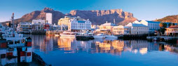
Cape Town Winter
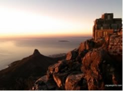
Table Mountain
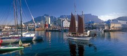
Cape Town Winter
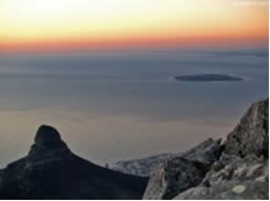
Table Mountain / Robben Island
Subscribe to:
Post Comments (Atom)
No comments:
Post a Comment